I meant to post this about 2 months ago, after my presentation at EDRA (Environmental Design Research Association). I presented about 2 weeks after I returned from Thailand, and appreciated the wonderful feedback I received at the conference. This is still a work in progress, and I am hoping to revisit and expand upon it in the near future. For now, here is the poster – at the link!

Wener_edra

Feedback is always appreciated! Feel free to comment here or email me personally.

On my last visit to the sunken temple, I happened to be there when a massive group of Thai tourists pulled up in motorized long tail boats. This group was visiting from Phuket, in the south of Thailand, and had been touring all around Kanchanaburi Province. I spoke to a few of them as they stopped to take pictures and pray inside. No one I spoke to had much of a sense of the history of the place. They had come, as one said, because they had to complete the Kanchanaburi circuit, and this was one of the stops. The groups strode up from their boats, took lots of photos, bought flowers for prayer offerings from the children waiting outside the temple, prayed, and then left to go back to their resorts in town. One man suggested that the shrine to Rev. Uttama inside the temple was off-putting – he thought that people would want photos of a historic site and the shrine would ruin their pictures.

I encountered these tourists after spending a few hours speaking with the small community that lives just uphill from the sunken temple. When the original village was flooded, a group of about five families stayed, moving to higher ground directly adjacent to the temple rather than going to Mon side. Several suggested that Uttama had asked them to stay and take care of the Temple. They are quite isolated in their settlement; there are no roads connecting the village to the surrounding area so they must take boats to get anywhere. The Thai government never built roads inside the village either; the monastery paved one road from donations they receive from visitors to the temple and former residents. They have no electricity, but the monk has said that if a few more people move to the village (it has slowly grown to 18 households), they will get it. Meanwhile, the children must be ferried by boat to Mon side if they want to go to school; the boat costs 250 baht/month (~ $9). The children sell flowers to tourists to raise this money. touristsTourists visiting the temple

bright_tourists3P1050423

The monk from the village near the temple sits watching the tourists visit.  Below, the children wait with flowers to sell to tourists. 

P1050430

For the first time, I hired a motorized long tail to go out to the temple (I usually canoe, but I was bringing a Mon friend to translate for me this time). This allowed me to get more photos of the trip out then normal. Below is a view of Mon Side from the water.

riverbank_merge

Most of the people I’ve interviewed about their lives in the old village and their subsequent relocation to the current Mon side have stressed the physical differences in the two villages – specifically, the crowding and steep terrain in the new settlement versus the flat and “peaceful” old village. I’m posting these to give a sense of the physical environment of Mon side today.


4_28bridgemerge11monside_lake mon hill merge1  monhillmerge2 monsidemerge3 monsidemerge4 monsidemerge5 roadmerge5_6 seq2

Yesterday morning, I canoed out to the sunken temple again. This time, I knew I would actually be able to get inside and (hopefully) swim around. The last time I was there, I could just see the top of the door, and the water has gone down a ton in the past few weeks. I borrowed an underwater camera from a friend and went to see what I could see.

The water was even lower than I thought it would be. We pulled up our canoe on the floating prayer house and swam out to the temple. Once inside, we could actually stand on the temple floor – the water came up to my chest/neck. We were joined by some Thai tourists who got out to the temple on a house boat around the same time that we got in the water. I think we inspired them and a few jumped in and followed us inside.

Swimming inside and around the temple was surreal and, at times, a little creepy. The water was pretty dirty and it was hard to even see my feet. I took a video; you can see how murky the water was.

And some photos from the morning:

2013-03-08 08.38.00

2013-03-08 08.38.152013-03-08 08.41.44

2013-03-08 08.41.59

2013-03-08 08.42.20

2013-03-08 08.43.14 2013-03-08 08.42.58 2013-03-08 08.42.37

2013-03-08 08.46.03 2013-03-08 08.46.28 2013-03-08 08.48.04 2013-03-08 08.48.46 2013-03-08 08.49.15 2013-03-08 08.53.41 2013-03-08 08.53.48 2013-03-08 08.53.54 2013-03-08 08.55.49 2013-03-08 09.06.23 2013-03-08 09.06.36 2013-03-08 09.07.31 2013-03-08 09.08.00

temple-waterlines_mar

It is pretty extraordinary to see just how drastically the reservoir water levels decrease over the course of a few months. I am going back out to the temple tomorrow (hopefully), but I’ve already seen the water go down by several feet.

temple-waterlines

The temple is approx. 30ft high. At the end of the rainy season, it is completely covered. Most years (hopefully this one), by the end of the hot summer season, the water goes down to not just uncover the temple entirely, but also create a small island at its base. The reservoir is quite large – it has a maximum storage capacity of 8,860 million cubic meters covering a total catchment area of 3,720 square kilometers. Average runoff into the reservoir is approximately 5,500 million cubic meters per year.

section1_with-underlay

sangkhlaburi1_sectionline

Apologies to all readers (in other words, Mom), I haven’t been quite as good about updating as I should be. I’ve been working on several drawings/maps as I continue my interviews, but life here in Sangkhlaburi tends to speed by and a week (or 2, or 3) pass by in what seems like days. Also, things come up to draw me out of my research and away from town. That’s what happened last Monday when I trekked into Burma for a few days to celebrate Mon National Day.

Mon National Day has been held for the past 66 years (since independence from Great Britain) as a celebration of Mon cultural heritage to instill ethnic pride and strengthen the spirit of Mon nationalism.  This year marked the first year that the Burmese authorities allowed Mon National Day celebrations in Yangon and outside Mawlamyine, the capital of Mon State. However, most Mon from the border regions were going to a celebration in Pa Nan Bane, about 8 hours on the Burmese side of the border from Sangkhlaburi.

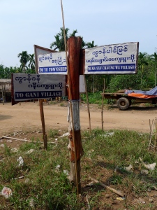
The last time I was here, restrictions were tighter and foreigners were not allowed to pass through the border near Sangkhlaburi into the semi-autonomous New Mon State Party (NMSP) controlled land where Pa Nan Bane is. Things have changed a bit, though, and I knew plenty of foreigners who had since crossed the border here. I had always wanted to “go inside,” as they say here; I had heard so much about the villages on the other side, and especially about Nysiar, where my students had studied and MWO has a large office. When my Mon friends asked if I wanted to come along to Mon National Day this year, I immediately said yes.

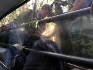
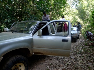
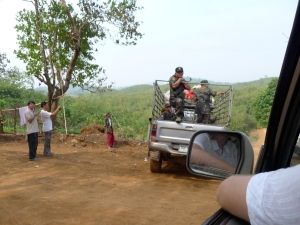
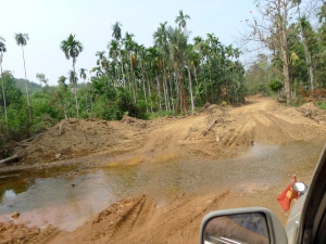
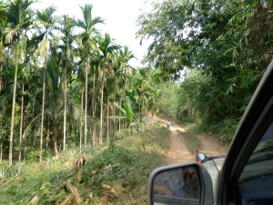
I woke early on Monday and biked to the Mon coordinating office, where several pick-up trucks had gathered. Dozens of us piled into the trucks (I was lucky to get a spot in the back of the truck cab – most spent the 8 hour ride standing in the truck bed), and sped off towards the border. Our whole trip inside took about 36 hours, 17 or 18 of which were spent on the roads. Road is a generous term to describe what we drove on for much of the time – we were off-roading in the Burmese jungle.

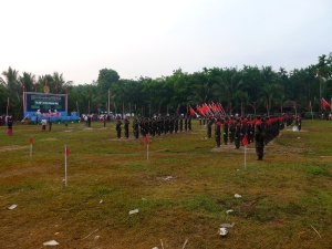
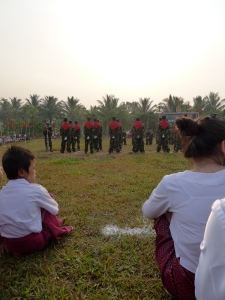
The journey was definitely the story. The actual Mon National Day ceremony on Tuesday morning is mainly a military affair with a parade and speeches in Mon. I had been to that five years ago when it was held right along the border; it’s interesting to see but means very little to me. Monday night, however, after the caravan of trucks finally arrived, and after I hopped into the back of a different truck to go to a former student’s village where I was spending the night, I was led to a small waterfall for a post voyage shower. I was aching, dusty, and tired. Lesson learned: showers in beautiful waterfalls after nine hours on terrible jungle roads are the best showers of all.

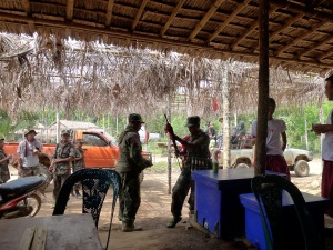
Unfortunately, I didn’t get any photos of the waterfall. Some pictures of the trip are below.

P1030080 P1030081

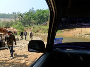
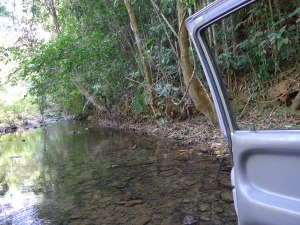
The trucks drove through about 30 rivers along the way; the journey is nearly impossible in the rainy season when these streams are much higher.

P1030083 P1030086 P1030087 P1030091 P1030092 P1030093

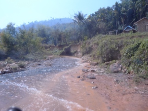
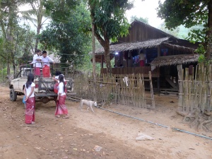
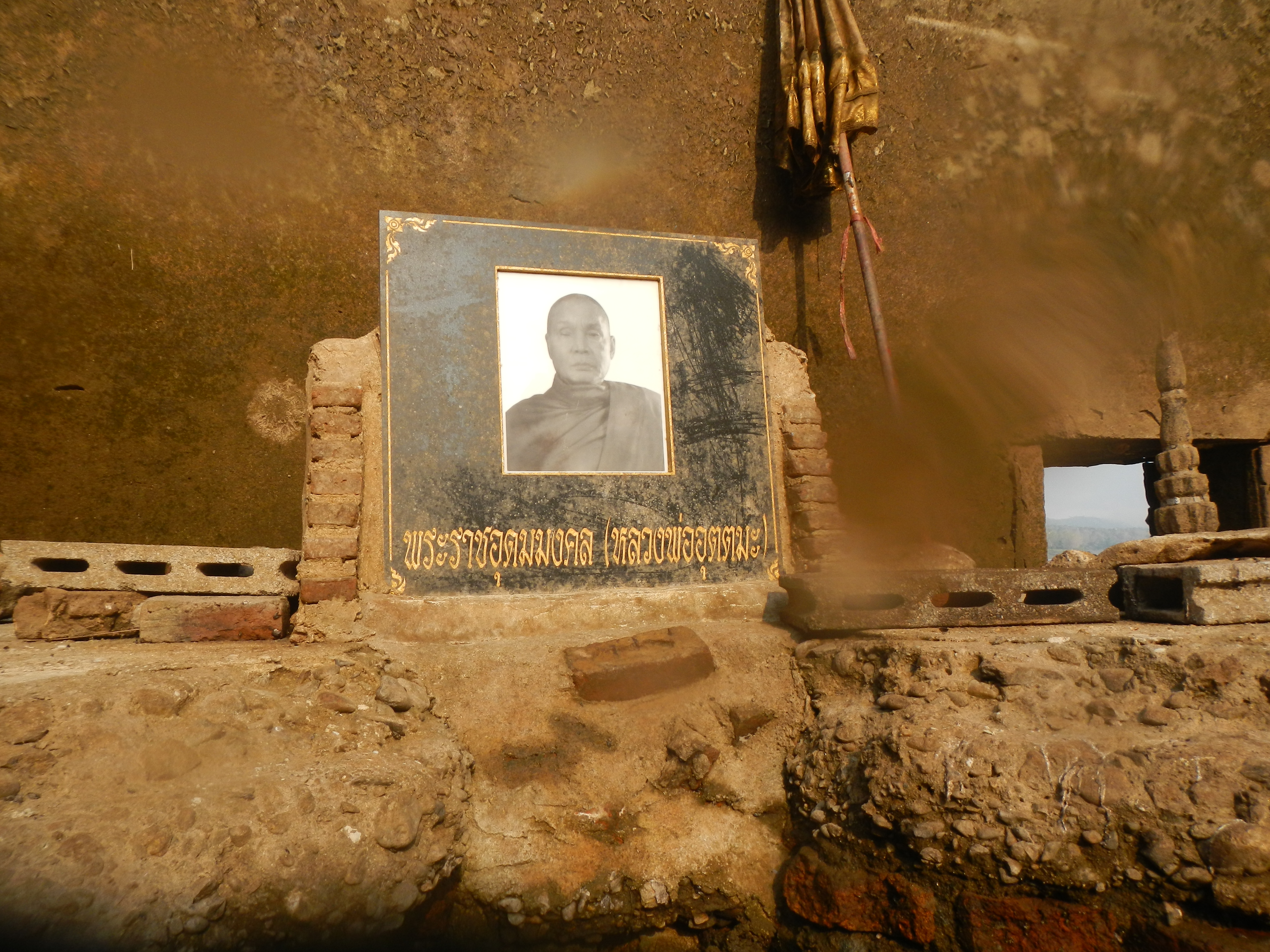
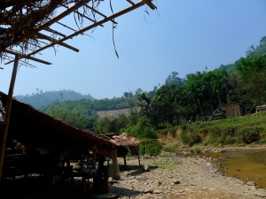
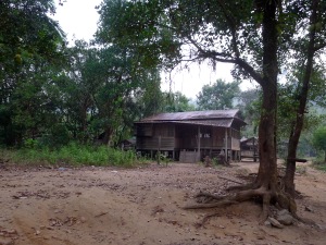
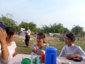
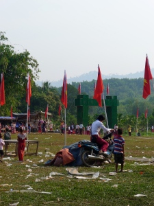
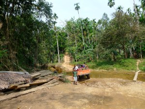
Above right: Pa Nan Bane. Above left: where I spent the night.

P1030096 P1030100 P1030105 P1030119 P1030121

And the trip back:

P1030129 P1030136 P1030140 P1030144 P1030145 P1030149

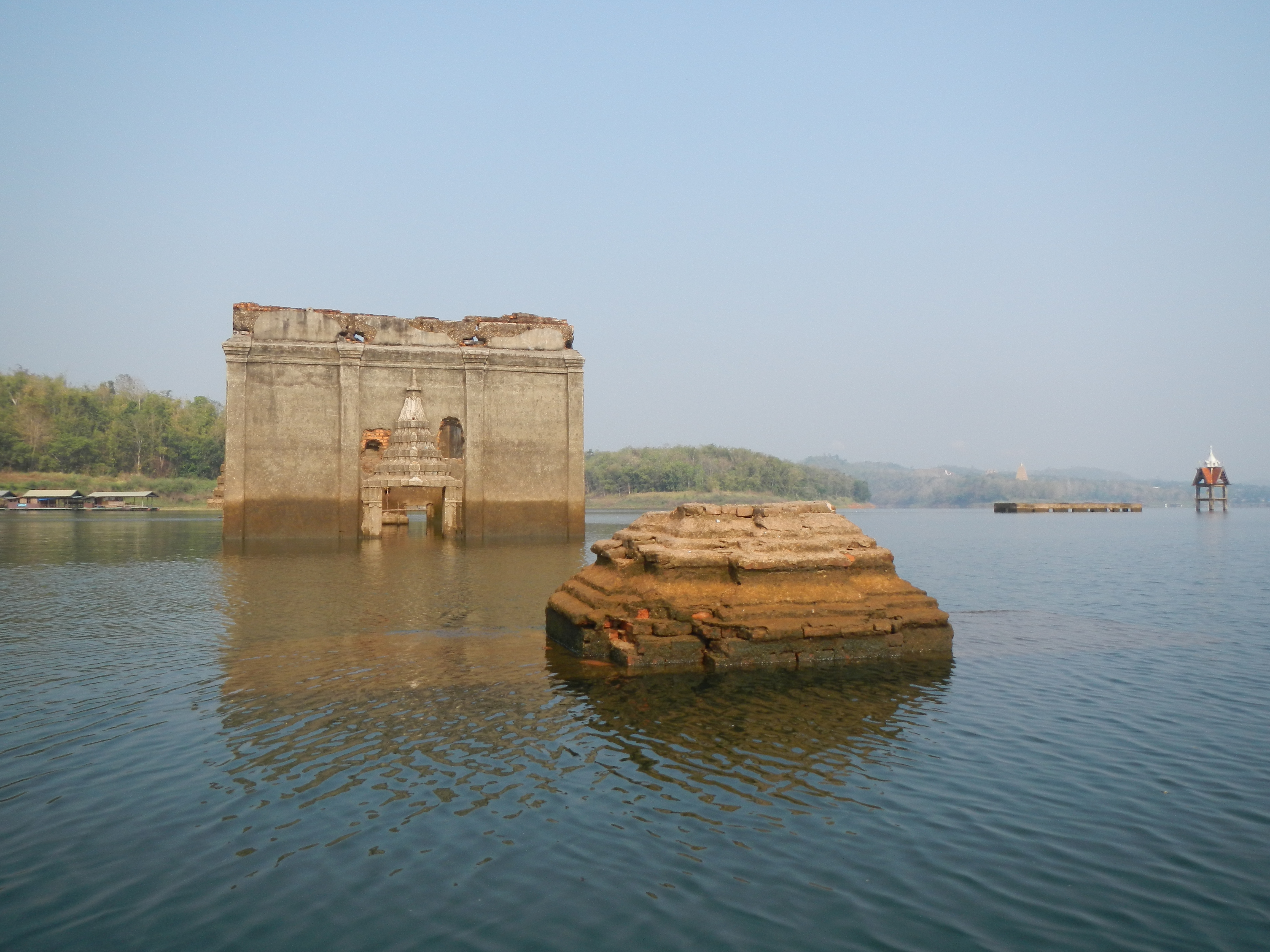
Back in Sangkhlaburi, we’ve been experiencing some untimely rains. It’s absolutely straight-up weird for it to rain in February here, and I don’t know what it will ultimately mean for the water levels around the temple. I’m trying not to worry about that too much – so far the water has continued to drop, week by week. At this point, you can swim through the temple door and around inside, which I plan to do on Thursday. More updates soon!
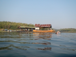
This morning, I woke up early to canoe out to the temple with Anya, a volunteer at MWO (where I used to work). We just caught the sunrise as we headed out towards old Sangkhlaburi.

2013-01-27 20.24.58 2013-01-27 20.28.49

I was so excited to finally get out in the water and see the temple. Anya was out about a month ago and said that the water is already much lower than it was then. The temple is still mostly submerged; by March/April, we should be able to actually get out of our boats here and walk around it.

2013-01-27 21.01.14 2013-01-27 21.02.54 2013-01-27 21.03.19 2013-01-27 21.04.59 2013-01-27 21.05.15 2013-01-27 21.06.36 2013-01-27 21.06.58

We weren’t the only ones making the early morning trip. As we approached the temple, we noticed a small motorboat docking at the floating structure below. We realized that it was a place for people to pray and make offerings, as is custom at Buddhist temples. The sunken temple clearly still operates as a sacred space, even when it is uninhabitable.

2013-01-27 21.07.37 2013-01-27 21.08.22 2013-01-27 21.11.35